Day trips from Toronto
4 stopsBest: May to October. And in October, for the maplesUpdated July 2026
Niagara Falls moves. The water erodes the soft rock under the lip, the hard cap is left overhanging and eventually breaks off, so the falls retreat upstream: they’ve gone back eleven kilometres since the last ice age and right now sit about eleven kilometres from where they started. At times they retreated over a metre a year.
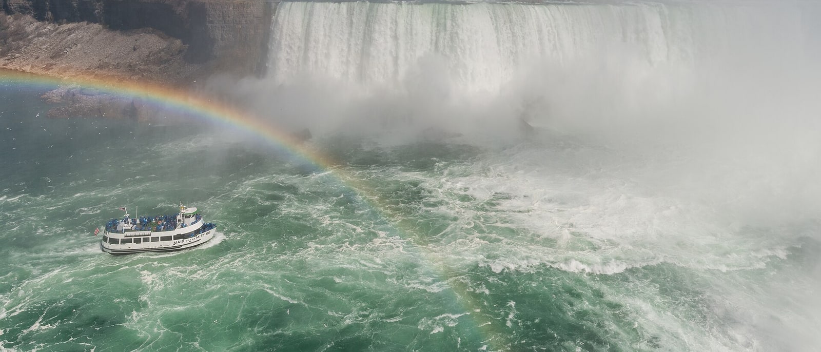
And the only thing that has slowed it is a human decision: diverting a good share of the flow to the hydro stations brought erosion down to around thirty centimetres a year. So the turbines don’t just take the water: they’ve changed its geology. That’s ninety minutes away, and it’s the compulsory trip. The rest from here is lake, wine and forest.
The route, stop by stop
4 STOPS- 01
Niagara Falls
The height disappoints: fifty-seven metres, less than many Toronto buildings. What impresses is the volume, which in summer daytime exceeds two thousand eight hundred cubic metres per second over the Canadian Horseshoe, and the noise, which you hear before you see them. The big fall is on the Canadian side, which is why Canada has the good view and the United States doesn’t, something New York isn’t keen on.
The way to see them is to get underneath: the boats that go to the foot of the Horseshoe leave you soaked even in the poncho, and that’s where you understand the volume. There are also tunnels cut behind the curtain of water.
And one thing to say so you don’t get a shock: the town next door is a funfair with wax museums and haunted houses. Go, look at the falls, then head north.
- 02
Niagara-on-the-Lake and the wine
Twenty minutes north of the falls, a village of early nineteenth-century timber houses, with a main street, a theatre and a fort from the War of 1812. It escaped everything, the funfair next door included, and it’s the exact counterweight to the day.
Around it is Canada’s main wine region, protected by the microclimate of Lake Ontario, which acts as a radiator and lengthens the season. And this is where ice wine is made: the grapes are left on the vine until December or January, until they freeze at minus eight or colder, and they’re picked and pressed frozen, at night. The water in the grape stays behind as ice crystals in the press and only the concentrated sugar comes out.
A whole vine yields a few drops, and that’s why it costs what it costs. Canada is the world’s largest producer, ahead of Germany, which invented it.
- 03
Prince Edward County
An island in Lake Ontario, two and a half hours east, that twenty years ago was farmland and today is Toronto’s weekend escape: small wineries, farms, cheesemakers and a village street with good restaurants. It’s what the countryside would be if there were countryside here.
What makes it odd is Sandbanks: there are freshwater sand dunes twenty-five metres high, with a beach, in the middle of a lake. They’re among the largest of their kind in the world and they don’t fit mentally with anything: it looks like the coast and you’re a thousand kilometres from the sea.
A car is compulsory and it’s a long day, so it works better with a night there.
- 04
Algonquin
Three hours north the Canada you have in your head begins: seven thousand square kilometres of forest and lakes, with moose, beavers and wolves, and no roads except one crossing it. It’s Ontario’s oldest provincial park, from 1893, and the classic way through it is by canoe, hopping from lake to lake and carrying the canoe on your shoulder in between.
But the reason to do the three hours is calendar: in late September and early October the sugar maple turns red and the whole forest changes colour for two or three weeks. It isn’t a metaphor or a retouched photograph: it’s the leaf on the flag and it genuinely happens.
The dates shift each year with the cold, and there are official reports tracking it week by week. If your trip lands there, this beats everything else on this list.
Frequently asked
How do you get to Niagara Falls from Toronto?
Ninety minutes south, by car, bus or train. The big fall, the Horseshoe, is on the Canadian side, so this is the good view. And the advice that changes the day: see the falls and then get twenty minutes north, to Niagara-on-the-Lake, because the town next door is a funfair.
Do Niagara Falls really move?
Yes: the water erodes the soft rock under the lip and the hard cap eventually breaks off, so the falls retreat upstream. They’ve gone back eleven kilometres since the last ice age and at times retreated over a metre a year. Diverting the flow to the hydro stations has slowed it to around thirty centimetres.
When do the maples turn in Ontario?
Late September and early October, for two or three weeks, and the exact dates shift each year with the cold: there are official reports tracking it week by week. The place is Algonquin Park, about three hours north of Toronto.