OZU /MONTENEGRO /PODGORICA /GUIDE
Podgorica’s neighbourhoods
4 h route4 stopsBest: At dusk: that’s when the city comes outdoorsUpdated July 2026
Podgorica is three cities stuck together, and the good part is you can tell them apart by eye, without knowing anything. You can see the seams: the height of the buildings changes, the street layout changes and the century changes. Walking from one to another takes twenty minutes and it’s the best walk the capital offers.
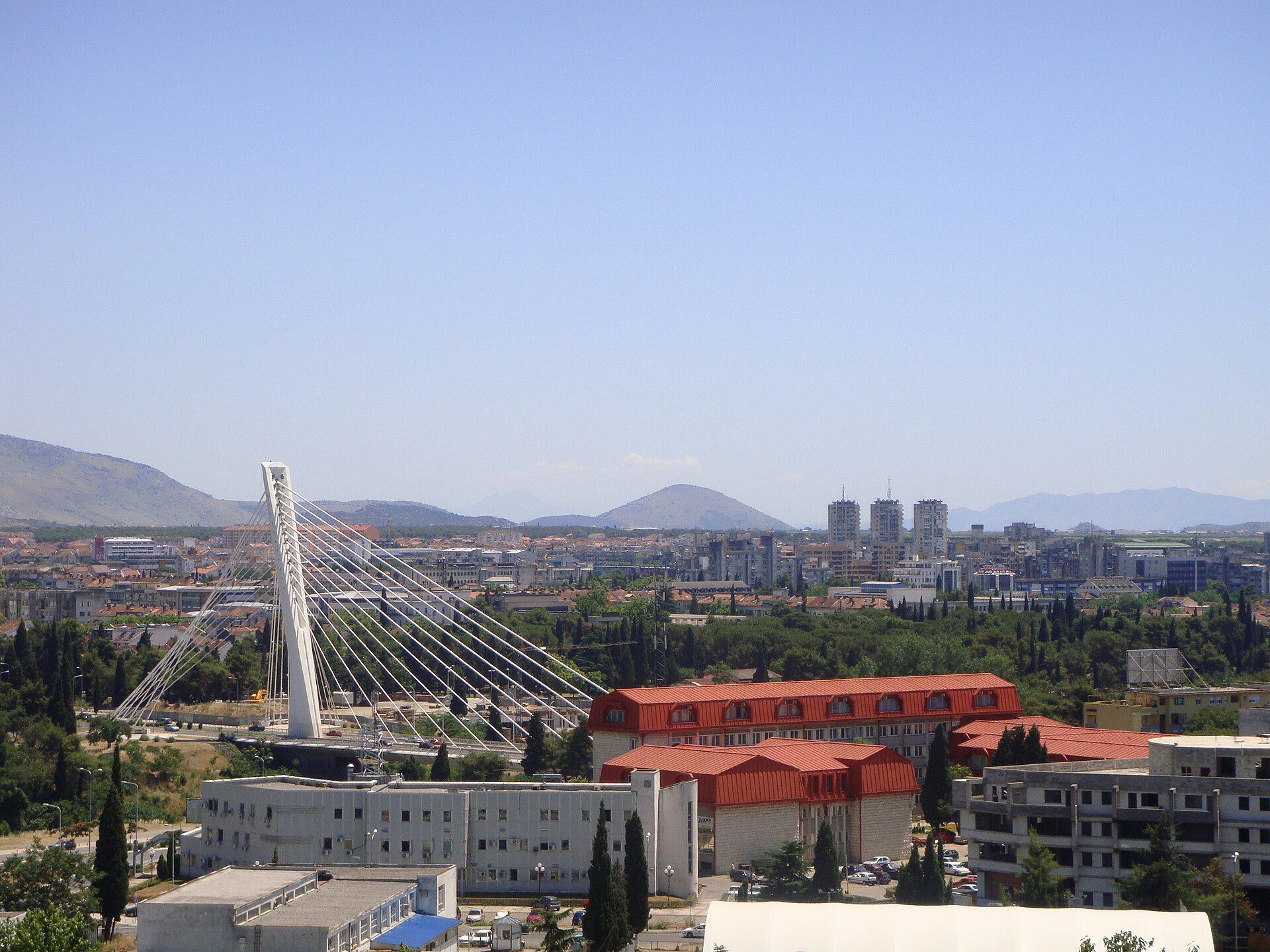
The first is the Ottoman one, Stara Varoš, east of the Ribnica: crooked streets, low houses, the clock tower. The second is the king’s, Nova Varoš, across the river: a tidy grid laid out when Podgorica passed into Montenegrin hands in the late nineteenth century, with avenues and two-storey buildings. And the third is Tito’s: the blocks raised after 1946, when this was Titograd and a capital had to be made from nothing. Three ideas of a city, one on top of another, in a place you cross on foot.
The route, stop by stop
4 STOPS- 01
Stara Varoš, the Ottoman one
The real old town, east of the Ribnica: narrow lanes that don’t take you anywhere in a straight line, one- and two-storey houses, stone walls, two mosques and the clock tower in the middle. It’s what remained of Ottoman Podgorica, a frontier trading post for centuries.
Don’t look for monuments here because there aren’t any: what to do is notice the layout, which is the whole argument. The streets follow no grid, they come and go, narrow and turn, because they grew without a plan. Cross the river to the next quarter and you’ll see straight avenues: that contrast, within a hundred metres, is the city’s history.
And note why this is still here: it wasn’t saved for its value, it was saved because it lay away from what the bombers were aiming at in 1944.
- 02
Nova Varoš, the king’s
Across the Ribnica begins the quarter called New Town, which has been called that for over a century. When Podgorica stopped being Ottoman, at the end of the nineteenth century, they didn’t set about remaking the old quarter: they made one beside it, and made it with ruler and set square, on a grid, with wide streets and aligned buildings. It was a way of saying somebody else was in charge now.
From that period is King Nikola’s palace, in Kruševac park, today an art gallery: a genteel country house, neither large nor imposing, which was the residence of the monarch of an independent kingdom.
That building says a great deal about this country’s scale. The quarter walks well, holds the centre’s cafés and is where life happens. And two consecutive streets teach you what no museum can: Ottoman chaos on one bank, nineteenth-century order on the other.
- 03
The Titograd blocks
To the west, and taking up most of what is Podgorica today, are the blocks. They went up from 1946, when the city was called Titograd and was the capital of a Yugoslav republic: wide avenues, rows of housing blocks, big squares and concrete. It isn’t pretty and it wasn’t trying to be. It was trying to house a lot of people fast in a place where nothing was left standing.
It’s worth walking there a while precisely because nobody does. It’s the real city, where people live, and it explains why central Podgorica feels the way it does: it isn’t that the city has blocks on the outskirts, it’s that the city IS that, and the old part is the small addition.
Notice the planning, which is textbook: open blocks, plenty of free space between buildings, trees. It was a specific idea of how life should be lived, executed on a budget and in a hurry.
- 04
Gorica, the neighbourhood that is a hill
In the middle of all the above there’s a pine-covered hill, and it gives the city its name: Podgorica is “under the Gorica”. That the capital is named after its hill and not the other way round says something about the order of things here.
It isn’t a residential quarter but a forest park, with paths, shade and a partisan memorial at the top. And it’s where you should come at six in the evening, when the sun eases, because that’s when the whole city appears: people running, families, kids. In a capital without great heritage, the liveliest place is a pine wood, and that isn’t a failure: it’s how Podgorica works.
From the top you see the three cities at once (the Ottoman maze, the king’s grid and the blocks) and you understand in a minute what took you an afternoon to walk.
Frequently asked
Where to stay in Podgorica?
In Nova Varoš, the nineteenth-century grid west of the Ribnica: that’s where the cafés, the restaurants and the life are, and everything is walkable. Stara Varoš, the Ottoman quarter, is nice to see but has little on offer. The Titograd blocks are cheaper and perfectly comfortable, but they’re a long walk from the centre.
What are Podgorica’s neighbourhoods?
Three, and you can tell them apart by eye. Stara Varoš, the Ottoman one, east of the Ribnica: crooked streets and the clock tower. Nova Varoš, across the river: the grid laid out in the late nineteenth century, with King Nikola’s palace. And the Titograd blocks, to the west, raised from 1946, which are most of the city. In the middle, Gorica hill.